
Photo by @Camrin Dengel courtesy of Teton Watershed Aquifer Recharge Project, Friends of the Teton River
ADAPTING TO CHANGE
This section builds from our working group meetings to examine various actions that could support irrigated agriculture and contribute to robust watersheds and communities. We discuss three general goals, as well as multiple strategies for achieving these goals. We also highlight constraints that might limit innovation, as well as opportunities for management and policy. Our intention is to provide information that can complement local knowledge and experience in ongoing efforts to meet specific goals and objectives at the farm or watershed level.
The continued vibrancy of agriculture is essential for food supply and for Montana’s economy, rural livelihoods, and cultural and natural heritage. As the state supports the agricultural sector in building the capacity to tackle present and future challenges, agriculture can, in turn, play an important role in planning for and meeting Montana’s future water demands. Because shifts in irrigated agriculture are coinciding with changes in climate and development (Box 5), it is critical to consider how to maintain or improve the resilience of Montana’s communities and natural resources.
BOX 5 - MONTANA’S CHANGING CLIMATE
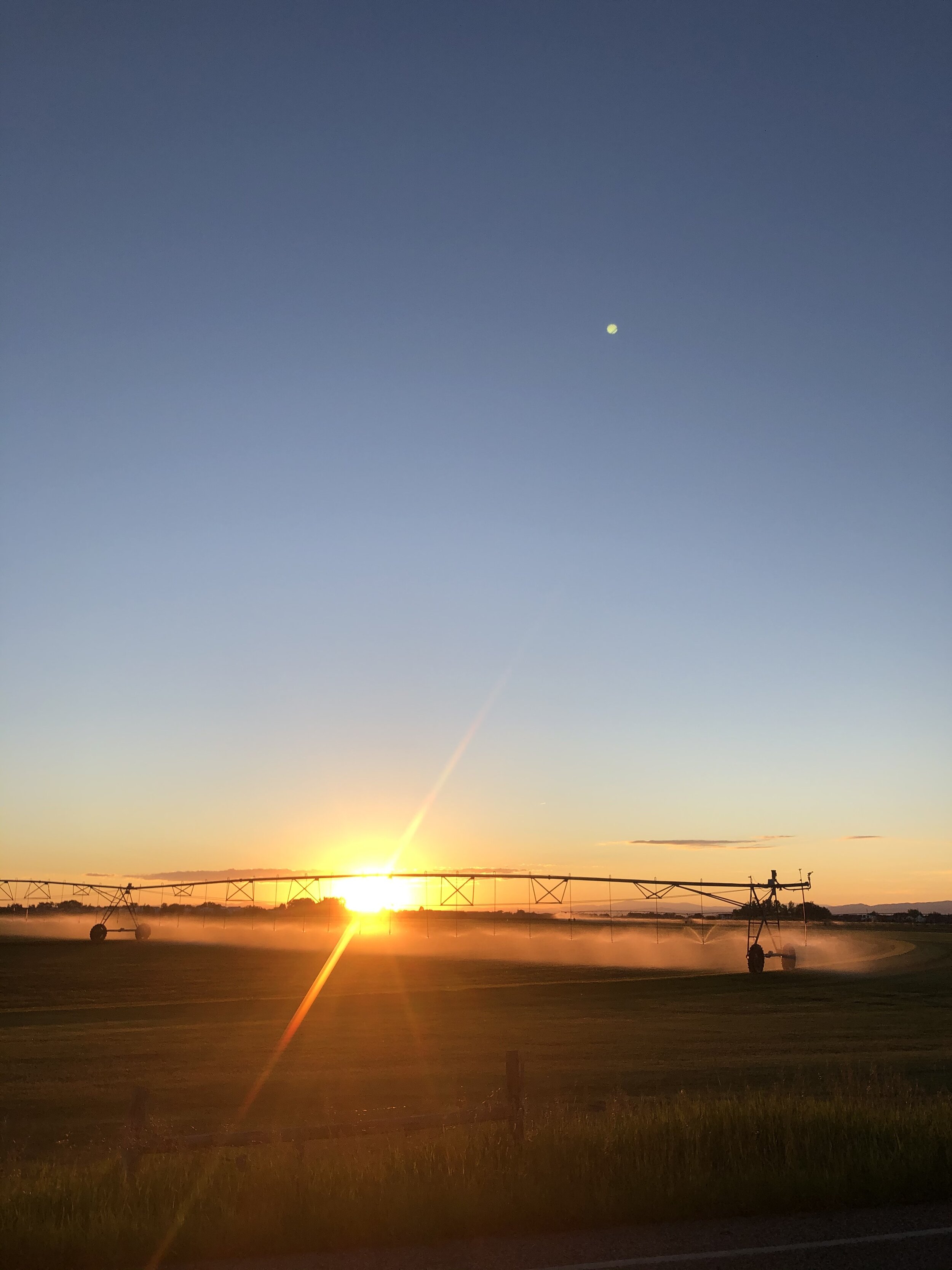
Photo by Wyatt Cross
frequency and severity of droughts during the summer months.
- Total annual precipitation in Montana is likely to increase slightly, but precipitation is projected to decrease during the summer months when demand is highest.
POTENTIAL EFFECTS ON IRRIGATED AGRICULTURE
- Reductions in snowpack, altered runoff patterns, and lower summer streamflow are likely to affect the capacity and reliability of irrigation water supply.
- Warming may extend the growing season and enable greater crop diversity, but increasing summer heat and drought will lead to greater water demand and potential stress on crops and livestock.
- Higher winter temperatures may allow winter annual weeds, such as cheatgrass, to increase in distribution and frequency across winter wheat cropland and rangeland.
OBSERVED CHANGES
Since 1950, average annual temperatures have in-creased by 2.7°F, a full degree more than the national average.
April 1 snowpack has declined ~20% since the 1930s, with the greatest declines at low elevations.
Peak spring runoff is arriving one to three weeks earlier, on average, in the Mountain West.
PROJECTED CHANGES
Warming will continue and is likely to be more pronounced in the summer.
Days above 90°F are projected to increase by 10 to 35 days per year by 2050.
Flood events and multi-year droughts will continue to be a part of Montana’s climate, as they have been in the past, with a strong potential for increased frequency and/or intensity of these events.
Changes in temperature, snowpack, and precipitation are likely to increase the
The impacts on water supply from these climatic changes will be exacerbated by population growth and development pressure. Source: Montana Climate Assessment, Whitlock et al. 2017 26
Goal 1: Watershed-scale Irrigation Management and Water Budgeting
Irrigated agriculture has a profound influence on watershed hydrology; consequently, irrigation water management can function, where desired, as a tool to help communities achieve locally identified water objectives. Effective planning to employ adaptation strategies and meet targeted watershed goals must begin with quality information, comprised of quantitative hydrologic data on water supply and use, as well as site- specific local knowledge of how water moves through the watershed. Gathering this information and building basic water budgets can help watersheds and irrigation districts plan more effectively to meet their identified objectives, as well as build model scenarios and plan for future challenges. A number of irrigation water management strategies are currently being employed around the state, creating a foundation to be built upon and expanded.
STRATEGY 1A: Development of quantitative water budgets
A quantitative water budget accounts for all of the inputs, storage, and outputs from a particular system, such as a watershed, an irrigation district, or an individual farm. As with any budget, its reliability and utility depend on the accuracy and availability of the information used to create it. In Montana, the quality and accessibility of water data varies greatly (Constraint 1A and Table 4) and, while water measurement is taking place in some managed basins, a lack of direct measurement in many areas of the state limits informed decision-making.
Accurate site-specific information, such as the data necessary to build a comprehensive water budget or an understanding of how policy influences seasonal water availability, can provide a powerful toolbox for considering actions and building solutions that fit particular watershed goals.37 In Idaho, for example, headgates with measurement devices track diversion rates in all watersheds, and the state is systematically investing in detailed hydrologic models to support agriculture, communities, and ecosystems. With real-time data and accurate measurements feeding these models, Idaho can explore how changes in climate, irrigation methodology, and land use might influence water supply. They can also use these models to consider actions and priorities, and to plan proactively to mitigate potentially adverse outcomes.
STRATEGY 1B: Voluntary drought management plans
Water users in many areas of Montana have come together to create voluntary drought response plans to minimize the adverse impacts of drought and low flow events. The Blackfoot Drought Response Plan38 is one such effort, which demonstrates the idea of “shared sacrifice” among all water users (i.e., irrigators, outfitters, anglers, recreational users, government agencies, homeowners
associations, businesses, conservation groups, and others) who “voluntarily agree to take actions that will result in water savings or the reduction of stress to fisheries resources during critical low flow periods.” This approach recognizes that drought and low flows are a watershed-wide concern, that individuals and entities throughout the watershed benefit from drought response efforts, and that the greatest benefit can only be achieved by the cooperative effort of the broader community. Within the broader Blackfoot Drought Response Plan, individual water users have developed drought management plans specific to their own needs and conditions. Voluntary drought response plans exist in other watersheds across the state, such as the Big Hole39 and the Jefferson,40and represent an important water management tool that can footnotes-1 community and drought resilience.
STRATEGY 1C: Flexibility in water management through irrigation districts
Irrigation districts provide unique opportunities for irrigation water management due to their scale, structure, and water rights configuration. Irrigation districts are quasi-governmental entities that are formed to manage the distribution and delivery of contract water. Each district contracts water delivery shares to producers within the boundaries of the district. The shares can be sold or transferred among different irrigators without requiring a change of water right, since the place and period of use do not change; this situation creates unique flexibility in terms of moving water within the system and optimizing water use in relation to demand or potential aquifer recharge efforts. Many of the districts are associated with large diversion or reservoir projects which provide water to thousands of irrigated acres using many miles of canals and ditches. The large geographic footprint of some irrigation districts can create challenges for management, but can also represent significant potential to influence the hydrology of the area.
Constraints and Opportunities Related to Irrigation Management and Water Budgeting (Goal 1)
as a guideline and will become enforceable statute once the final decree of water rights in Montana is complete. Nonetheless, whether the risk is real or perceived, the fear of abandonment remains widespread. As such, it serves as a strong disincentive for water rights holders to adjust use according to need or scarcity, and has become a specter that looms over many well-intentioned water conservation efforts. House Bill 54 in the 2017 legislative session sought to amend the water right abandonment tenet to allow water users to cease all or part of use of a water right during a drought and in compliance with a local, regional, or state drought plan. The bill failed; however, if water rights holders could reduce their water use during times of water scarcity without fear of abandonment, or even to meet community watershed goals, more possibilities would exist for adaptive, creative solutions for water management.
CONSTRAINT 1D: Development and fragmentation of agricultural land
Watershed-scale irrigation management and many of the strategies outlined in this document necessitate collaboration and collective action among water rights holders, landowners, and other community members. Voluntary drought management, for example, is only effective if the vast majority of water users participates, and the use of irrigation canals to promote aquifer recharge requires agreement and cooperation among multiple water users within a ditch network or canal system. Increasingly, especially in the western half of the state, watershed-scale irrigation management has to take into account changes in land use and the growing fragmentation of agricultural lands due to development and population growth. When a farm or ranch is sold and the land is subdivided, the water right is also divided among the multiple new landowners. In these cases, collective action to achieve a particular objective using irrigation infrastructure may become more difficult because of the multiple interests among new landowners and an increasingly diverse set of water use goals. In the face of these changes, local watershed groups become increasingly important in their ability to build trust, foster understanding of the local context, and cultivate site-specific solutions to match watershed needs. Additionally, efforts to better integrate water use planning into land use planning will enable watersheds and communities to address potential challenges in a more proactive mannor.
CONSTRAINT 1A: Limited water supply and use information
There are significant gaps in the information necessary to construct reliable water budgets to inform planning (Table 4). For example, actual diversion rates throughout the season are not accessible for much of the state, empirical data on field application rates is broadly lacking, and accurate measurements of the effects of irrigation return flow on streamflow only exist where specific studies have taken place. Only recently have methods been developed to use remote sensing to estimate evapotranspiration. 41-43 It is also important to build knowledge about other factors that influence water availability and how they interact with hydrology. For example, it is essential to understand how policy enables or constrains particular strategies, as well as the socio-cultural and economic factors that drive decision-making within a particular watershed.
CONSTRAINT 1B: Funding for data collection and analysis
Data collection, management, and analysis require significant financial investment. Automated forms of data collection may require considerable initial funding but less to maintain in the long-term, while other forms of data collection may require steady, ongoing resources. To be useful, all data must be managed in a way that makes it accessible, and data cannot inform decision-making without analysis to interpret what it means. Resources for education and outreach efforts are also critical for creating pathways of information exchange among researchers, policy makers, and practitioners.
Table 4 summarizes gaps in data for key elements of the water budget, as well as other information needs that could contribute to better understanding and informed planning around irrigation efficiency.
CONSTRAINT 1C: Water right abandonment policy
The water right abandonment tenet,43commonly referred to as “use it or lose it,” is widely perceived as a requirement that water right holders use their full water right each year or run the risk of losing it. However, while the tenet holds that use of the water right is important, it does not explicitly require a water right to be used in full every year; abandonment occurs when a water user stops using all or part of a water right for a period of 10 successive years. Interestingly, the water right abandonment tenet currently exists solely
Knowledge Gaps
| TOPIC/WATER BUDGET COMPONENT |
KNOWLEDGE GAPS |
|---|---|
| Surface Water Supply | • Continued and expanded surface water monitoring in Montana at strategic locations • State-of-the-art modeling efforts to predict how changes to the environment or management practices might influence water supply • More nuanced/detailed and site-specific understanding of GW influence on surface water supply |
| Aquifer Recharge | • Realistic estimates of irrigation return flow effects on streamflow • Quantifying irrigation-related recharge as a component of the larger water budget |
| ET/Crop consumption | • High resolution remote sensing to provide accurate estimates of evapotransportation |
| Diversions | • Update maps of ditch location/extent • Simple and reliable automated instrumentation for diversion measurement and reporting |
| Field Application | • Empirical data on actual irrigation water application rates/quantities |
| Water Budget Data Compilations | • Update past efforts such as Water Resource Surveys and 1978 NRCS Water Conservation Salvage Report |
| Montana Irrigation and Conversion Rates | • Reliably mapped irrigated lands, including spatial extent, crop type, irrigated acres • Quantification and assessment of lined and unlined canals |
| Information Transfer & Education | • Knowledge transfer among irrigators, policy makers, scientists, agencies, with information flowing in all directions • Clarity in nomenclature and terminology • Promoting understanding of hydrology around irrigated agriculture to a broader audience |
Table 4 | Knowledge Gaps. Key knowledge gaps related to specific water budget components and our general understanding of the hydrology of irrigated agriculture.
Goal 2: Supporting Aquifer Recharge
In many watersheds across Montana, water is stored naturally in winter snowpack and large alluvial aquifers. Water users depend on these forms of natural storage to provide sufficient water for irrigation and adequate streamflow, especially during the late summer and fall. The conversion from flood to sprinkler irrigation is likely to reduce aquifer storage over time through reduced irrigation seepage. In addition, climate warming continues to deplete winter snowpack. It is therefore important to consider other means of slowing down plentiful spring flows and storing water for use later in the year or farther dow nstream. Given the extremely high monetary and environmental costs of building dams and reservoirs, and the significant evaporative loss from existing reservoirs,¹ managing or manipulating aquifer recharge could provide a solution for increasing storage and resilience to drought. Such recharge can support wetlands, maintain aquifer levels and domestic groundwater wells, and sustain groundwater contributions to streamflow. In addition to bolstering streamflow, return flow can provide a cooling effect on streams, which can be particularly important during late summer and early fall when water temperatures can approach dangerous thresholds for certain aquatic species.⁴⁵ Agricultural infrastructure may offer an underappreciated means for aquifer recharge, even as conversions to sprinkler irrigation continue.
STRATEGY 2A: Maintain unlined canal infrastructure
weighed against any potential benefits of lining canals such as leaving more water instream at the time of diversion, reducing water consumption from canal vegetation, and lessening erosion along canal network canal seepage could be managed to achieve more targeted watershed goals, such as bolstering streamflow during times or at places of low supply and high demand. These gains would need to be weighed against any potential benefits of lining canals such as leaving more water instream at the time of diversion, reducing water consumption from canal vegetation, and lessening erosion along canal networks.
Unlined irrigation ditches are a significant source of aquifer recharge in many irrigated watersheds (Case Study 2).46-47 As producers convert to sprinkler irrigation and recharge from flood irrigation is reduced, unlined canals will continue to provide substantial aquifer recharge. Additionally, with an improved understanding of how, where, and when canal seepage influences streamflow, canal seepage could be managed to achieve more targeted watershed goals, such as bolstering streamflow during times or at places of low supply and high demand. These gains would need to be weighed against any potential
CASE STUDY 2: Aquifer recharge through use of irrigation canals in the Beaverhead (MT) and Teton (ID) watersheds
One strategy for recharging alluvial aquifers and bolstering late-season streamflow involves running water through unlined irrigation canals before and/or after the irrigation season. This concept is currently being explored through hydrologic modeling studies as well as on-the-ground efforts. Here we present a study of the Beaverhead River and its associated irrigation canal network by the Montana Bureau of Mines and Geology (MBMG),⁴⁷ as well as a collaborative project by the Teton Water Users Association, a watershed group from the Teton River, Idaho.⁴⁸
BEAVERHEAD RIVER, MONTANA
The Beaverhead River, flowing between Clark Canyon Reservoir and Twin Bridges, is one of two major tributaries that form the Jefferson River. Surface water irrigation dominates in this area, with most water distributed via two major canals that flow along elevated floodplain ‘benches’: the West Bench Canal and the East Bench Canal. In 2010, MBMG initiated a study to assess a variety of interactions between irrigation management and hydrology. As part of this effort, quantitative models were developed to explore the influence of running ‘extra’ water in the canals before and after the irrigation season to recharge floodplain aquifers and help offset depletions from irrigation well pumping. In addition, these models were applied to assess the contribution of irrigation return flow to the Beaverhead and how augmented canal seepage might influence this contribution. MBMG investigators determined that ~20% of the annual streamflow in the Beaverhead River derives from canal seepage reentering the river as return flow. The models showed that extending the period of canal flow (i.e., one month prior to and following the irrigation season) effectively offset the groundwater drawdown and reductions in streamflow resulting from irrigation wells. In addition, the extended period of canal flow increased average annual baseflow in the Beaverhead by ~ 5%, even when current pumping rates were maintained (after 20 years of simulated changes). Spatial and temporal aspects of baseflow augmentation were not explored within the scope of the study.
Insightful studies, such as this one, are becoming more common and results are helping to provide critical information needed to develop creative, ‘win-win’ solutions. An interesting, real-world example of such a solution comes from the Teton River in Idaho where resurrected flood irrigation canal systems are being used to recharge aquifers and bolster late season streamflow.
TETON RIVER, IDAHO Idaho’s Teton River flows along the west side of the Teton Mountains, originating near Victor and flowing into the Henry’s Fork of the Snake River near Rexburg. Water supply for irrigation and municipal use in the Teton Valley is snowmelt-dependent, with runoff from the high elevation Teton Range leading to peak spring flows in late May/early June followed by a low baseflow period in August and September.

Photo by @Camrin Dengel courtesy of Teton Watershed Aquifer Recharge Project, Friends of the Teton River
the TWUA funded the necessary repairs to the defunct canal system to begin an innovative and collaborative aquifer recharge program in 2018; the program is now in its third year. Once the ground thaws and before downstream rights come into priority, spring runoff water is diverted from the Teton using existing water rights and providing what is referred to as “incidental aquifer recharge.” In a return to flood irrigation-like canal management, water is diverted as soon as it is legally available and spread through a reactivated canal system. Producers and canal companies recognize the value of the program, but their participation is also made possible and incentivized by grant dollars that are relative to the recharge they provide. The program is also piloting “managed aquifer recharge,” in which a temporary water right is obtained to bring water to a particular location for focused aquifer recharge. These additional water rights are purchased with program funds. Both types of recharge are allowed under Idaho water policy and encouraged by the state, as there is widespread recognition of the value of aquifer recharge as a means of storing water and building resilience. There is also recognition beyond the Teton Valley in terms of the value of aquifer recharge and natural water storage for increasing late season streamflow, particularly from downstream producers. While initial funds for the first five-year pilot program have been obtained from outside grants, there is considerable potential for a long-term water market, in which downstream users (producers, municipalities, etc.) would pay for aquifer recharge in the headwaters, to increase reliability of late season water supply. The Teton River watershed has much in common with many headwaters watersheds in Montana and, although water policy differs between the two states, the general strategy is applicable and could provide similar benefits, depending on site-specific factors.
Producers in the Teton primarily grow hay and malt barley and raise beef cattle. The majority of the water rights in the headwaters are junior and calls on these rights are made by downstream senior water users in most years. The majority of producers in the Teton have switched from flood to sprinkler irrigation over the last 40 years; this conversion has enabled them to irrigate longer into the season given their junior status, produce two hay crops per year instead of one, and improve barley yields and malt quality. However, over the past 20-30 years, producers have noticed changes in the way water flows through their valley: springs they had relied upon dry up earlier in the year, or disappear entirely, and wetlands have diminished significantly in size. At the same time, Friends of the Teton River (FTR) and the Henrys Fork Foundation (HFF), two local non-profit groups, had been collecting data that showed declining summer streamflow, rising stream temperatures, and significant declines in aquifer levels – data that coincided with the observations of the producers. While tensions had formerly existed between FTR and valley irrigators, there was increasing recognition of the damaging impacts of declining summer streamflow for agricultural livelihoods and the local fishery alike. This shared concern over a shared resource led to the formation of the Teton Water Users Association (TWUA) and collective brainstorming on how to restore aquifer levels and bolster late season streamflow.
Members of the TWUA acknowledged the value of flood irrigation methods for slowing down and spreading out plentiful spring runoff water and storing it in the watershed for later use. Yet they also knew the importance of sprinklers for later season irrigation when water is typically scarce. The formerly used, unlined canal network, largely still in existence, provided the ideal strategy to allow for early season aquifer recharge while maintaining sprinkler irrigation. Using grant dollars,

Photo by ©Chris Boyer / Kestrelaerial.com
STRATEGY 2D: Floodplain reconnection
By slowing and spreading flood water, floodplains provide the opportunity for aquifer recharge, as well as exchange between groundwater and surface water that can help to keep stream temperatures cool (also see Box 4). Floodplains also support wildlife habitat, help to maintain water quality, and can reduce flood stage. Across the U.S., flood control efforts have disconnected floodplains from waterways on a large scale, eliminating their natural functions. Managing and restoring floodplains in agricultural lands adjacent to rivers can increase aquifer recharge and help to mitigate flood risk. As an example, on the Yellowstone River, channel migration easements – a specific type of conservation easement – enable landowners to use their land while also allowing natural channel migration and flooding. The program compensates landowners for land that is lost to erosion or flood damage in lieu of bank armoring or other developments that limit river and floodplain function.49 Other tools for enabling natural floodplain function include limiting floodplain development through land use planning, protecting or restoring riparian buffers, managing livestock grazing to promote healthy riparian vegetation, and managing woody invasive species such as tamarisk and Russian olive that compete with native species of willow and cottonwood.
STRATEGY 2E: Hybrid irrigation management
Hybrid irrigation management refers to the use of multiple irrigation methods across a farm or group of farms, or changes in method over time throughout the irrigation season. Some producers may already use hybrid irrigation management because the geologic or physical characteristics of their land necessitate the
creative use of different approaches in different locations. Producers may also choose to voluntarily experiment with hybrid irrigation management in order to maximize the benefits of different methods or to optimize water use relative to seasonal availability. For instance, when water is plentiful in the spring and early summer, irrigators could use high-capacity sprinklers to apply excess water, or flood irrigate where possible, effectively supporting aquifer recharge. Later in the growing season when water becomes more limited, irrigators could return to standard sprinkler irrigation to optimize the balance between water supply and use. There are clearly operational constraints to employing this type of hybrid irrigation management, and these could limit the broad scale application of this strategy (Constraint 2A below); yet, for certain farms and producers this could be a feasible option. Methods and management practices could be combined to support particular water supply goals or ecological needs (Table 2), which will likely vary from one location to another.
Hybrid irrigation management could also be envisioned at a watershed scale, where diverse methods are proactively planned or maintained across large spatial scales to achieve desired watershed goals, such as maintaining summer streamflow (Case Study 3). As illustrated in Table 2 there are a variety of costs and benefits of both flood and sprinkler irrigation for the producer, nearby producers, and the surrounding watershed and ecosystems. Where producers may be interested in maintaining flood irrigation, and where a mix of irrigation methods may contribute to shared watershed goals, e.g. bolstering aquifer recharge or maintaining migratory bird habitat, producers could be incentivized to offset some of the challenges to sustaining flood irrigation such as the significant time and labor needs.
CASE STUDY 3: Maintenance of diverse irrigation methods to optimize water supply in Gold Creek, MT
The Gold Creek watershed provides an interesting example of how maintaining diverse irrigation methods within a watershed can optimize water supply and benefit agriculture and aquatic ecosystems.
Gold Creek is a tributary of the Upper Clark Fork River which originates in the Flint Creek Range and flows 15 miles to its confluence with the Upper Clark Fork between Drummond and Deer Lodge. The agricultural mosaic in Gold Creek consists of six to seven larger ranches and a few smaller ranches, which were all flood irrigated until the late 2000s. During flood irrigation, flow in the lower end of the creek was often reduced to a trickle from mid-summer to early fall, and two stretches of Gold Creek were frequently dewatered during the summer months. One of the largest flood-irrigated ranches in the valley sits at the top of the watershed; return flow from this ranch and other smaller flood-irrigated ranches in the middle of the watershed discharges to the creek about three miles from the confluence. With the whole valley in flood irrigation, this additional streamflow was largely diverted by lower irrigators, and the final half mile of Gold Creek was regularly dewatered, disconnecting it from the Clark Fork River.

Photo by Jed Weingarten
Now, with consistent return flow contributions from upper Gold Creek and the lower ranches diverting significantly less water, streamflow of 10 cfs or more is consistently maintained in the last three miles of the creek. Increased streamflow, in conjunction with riparian fencing, fish screens on diversions, and off-stream stock water development, is expected to lead to healthier riparian areas and an improved fishery.
While this exact scenario may not be applicable in other watersheds due to site-specific geology and geography, the general concept is worth consideration as a way to optimize water supply benefits across a watershed.
Tributary mouths are ecologically critical areas, as they allow fish access to spawning grounds and cold water refugia essential for their survival. Disconnection of tributaries from mainstem rivers, particularly during warm, low flow months and spawning season, can be catastrophic for local fish populations.
In 2007 and 2008, two of the larger ranches on the lower end of the creek converted to center pivots. The ranch with the last two diversions on the creek switched to pipe-supplied center pivots, requiring approximately one-quarter the amount of water previously diverted to the operation. Irrigators at the middle and upper end of the watershed continued to flood irrigate, providing significant groundwater recharge upstream.
Constraints and Opportunities Related to Supporting Aquifer Recharge (Goal 2)
Recharge strategies using infrastructure and practices already in place, such as running canals pre- or post-irrigation season, might be considered “incidental” recharge and could take place under existing water rights. It is typically understood that water will be diverted into ditch systems before the irrigation season to “prime” the system; thus, expanding this practice to create additional incidental recharge may be feasible under current policy. In contrast, strategies that require new infrastructure or practices, such as infiltration galleries, would not likely qualify as “incidental” uses of water and may be subject to greater policy hurdles and water permitting requirements.
For situations where new water permits are required, current permit complexities and restrictions could be addressed to enable broader use of ASR. Water available under existing rights could also be used more widely for aquifer recharge given increased flexibility in policy (within a Prior Appropriation context) and greater efficiency in the water right change process. For example, surface water or wetland restoration do not generally require a water right, as long as water is minimally manipulated; if aquifer recharge could be considered ‘groundwater restoration’ and could be accomplished with minimal manipulation (i.e., running water through existing irrigation canals pre- and post-season), it could become more broadly feasible. Additionally, although water leasing is typically focused on maintaining instream flows, the use of leased water could be extended to include aquifer recharge.
CONSTRAINT 2D: Scope of incentives for irrigated agriculture
A number of state and federal agencies offer loans and incentives for irrigators to modernize irrigation systems and equipment (i.e., installing sprinklers) with the goal of improving crop production and conserving water. Yet, given the site-specific costs and benefits of both flood and sprinkler irrigation, innovative incentive programs that support diverse irrigation methods could be considered. Financial support for producers who prefer flood irrigation could, in some watersheds, provide hydrologic, ecological and socio-cultural benefits at individual and watershed levels. Research has shown that producer decision-making is motivated by a broad spectrum of factors beyond profit maximization, including maintenance of cultural identity, long-term operational viability, and land management ethics. Incentive programs that consider the diversity of motivators, in addition to offering financial support, may be more effective.5
CONSTRAINT 2A: Infrastructure and operations
The feasibility of using different irrigation methods on a single farm across an irrigation season may be limited by the challenges of maintaining irrigation equipment, conveyance infrastructure, landscape topography compatible with multiple methods, and labor costs. In addition, if the goal is to use canal infrastructure before and after the irrigation season to support aquifer recharge, annual maintenance that generally takes place during the same timeframe would have to be accommodated, and restoration of defunct canal infrastructure might be necessary.
CONSTRAINT 2B: Period of use
Nearly all irrigation water rights in Montana have periods of diversion that fall between April 1st and October 31st, based on the typical growing season. Although water users can vary their periods of use as long as the dates fall within their periods of diversion, they cannot change the periods of diversion under current Montana law because of the potential increase in water use. As the growing season lengthens and snowpack runs off earlier in the spring, rigid periods of diversion may become problematic. Irrigation water rights are some of the oldest water rights in the state, many with priority dates in the mid-to-late 1800s to early 1900s. This means that modern-day irrigators are constrained by water rights predicated on climate conditions from well over a century ago. Within the Prior Appropriation context, addressing the rigidity of the system or adjusting periods of diversion and use based on current climate conditions could enable strategies such as capturing high spring flows in irrigation canals or irrigating crops earlier or later in the growing season.[n][0]
CONSTRAINT 2C: Beneficial use and aquifer recharge
In Montana statute,aquifer recharge is defined as the controlled addition of water to replenish the aquifer, with the sole purpose of offsetting adverse effects from surface water depletions. Aquifer storage and recovery (ASR) projects are defined as the use of an aquifer to temporarily store water through various means such as surface spreading or drain fields, and water can be pumped back out or can “naturally drain away for a beneficial use.” It may therefore be possible for an ASR appropriation to be used to support fish and wildlife by augmenting stream flow in the late summer. Some basins that are closed to further water appropriation have high- water year exceptions to closures, and water during these years could theoretically be used for ASR projects that support fish and wildlife or some other beneficial use.
Goal 3: Water Conservation
Irrigators can voluntarily lease all or part of their historically diverted water to a third party while still retaining ownership of their water right. Water leasing was established in 1985 when fisheries and other natural values were recognized as a beneficial use of water. Like all other water right changes, leasing is overseen is overseen by DNRC and is subject to the same public notice and objection process as other water right changes. Requiring a water right change ensures that other water users have the opportunity to object to any adverse impacts that might occur, yet it is also a limiting factor on the extent of water leasing that currently takes place in Montana.
Water rights can be leased, sold, or changed in Montana. Most water leasing occurs through individual water right owners leasing or selling water directly to another entity, e.g. Montana Department of Fish Wildlife and Park, Trout Unlimited, and the Clark Fork Coalition. Some Western states, such as Colorado, Oregon 51-52 and California have legal frameworks or programs for temporary water leasing where producers can choose to lease a portion of their water rights temporarily, generally later in the growing season or during drought. This strategy can free up water for other uses and provides producers with alternative income at a time when full-scale crop production might be difficult. Temporary, or short-term, water leasing is often subject to less regulation than long-term leasing, which may allow it to be applied at broader scales and in times of need, crisis, or uncertainty. The Montana legislature passed a bill (HB 37)53 in 2013 to allow short-term leasing outside of the water right change process; it is uncertain how much this practice was utilized, and the framework expired in 2019.
Water leasing associated with a reduction in irrigated land can be a direct way to reduce consumptive use and maintain water instream to support fisheries and ecosystem processes (Box 3). Leasing is often most impactful on tributary streams where a small amount of additional flow can make the difference between a dry streambed or a functional aquatic ecosystem. Even a flushing flow of leased water as short as 48 hours in duration may benefit fish during critical spawning periods. If leasing takes place in the context of conversion to sprinklers (and reduced diversions), it may result in more water instream at certain times but is unlikely to lead to overall water conservation due to the potential for increased crop consumption (see Paradox of Irrigation Efficiency above).
In many Montana watersheds, demand for water during late summer often exceeds supply, and many water management strategies are designed with the goal of sustaining water supply or reducing water use. In this context it is important consider actions that could reduce water consumption. Some strategies, such as switching to sprinkler irrigation, alter the timing of water availability and reduce diversions but do not necessarily reduce the amount of water consumed. Reducing water consumption in irrigated agriculture can be achieved by reducing any of these three factors: intended consumptive use (crop use), unintended consumptive use (weed growth and evaporation), or unrecoverable seepage (water that is functionally removed from the watershed by contamination or percolation to inaccessible aquifers; Table 3).
STRATEGY 3A: Irrigation timing and precision
Irrigation timing involves minimizing evaporation by applying water at times when temperatures and wind speeds may be lower. Low sprinkler heads may also minimize evaporation by applying water closer to the crop. Because evaporation removes water from the farm or watershed without benefitting crop growth, reducing this aspect of consumptive use is a useful strategy. The Montana Mesonet, 50 a project of the Montana Climate Office, has increased the availability of local weather and soil moisture data by establishing a network of new monitoring sites across the state. This effort can help producers reduce unintended evaporation by reducing unnecessary irrigation.
STRATEGY 3B: Building soil health
Building healthy soils increases the overall resilience of agricultural systems by reducing erosion, increasing productivity, and increasing nutrient retention. Improving soil health by increasing soil organic matter also increases the water-holding capacity of the soil, which is particularly important for drought resilience. Many practices that improve soil health reduce evaporation from the soil, i.e. conservation or minimum tillage, planting cover crops, and creating soil cover with mulch or crop residues. Rotating or diversifying cropping systems can reduce weed competition, thereby reducing unintended consumption.
STRATEGY 3C: Water leasing for instream flow
Water leasing changes the beneficial use of existing water rights from irrigation to instream flow for fish and wildlife benefits, and can be an effective management tool in watersheds where dewatering impacts healthy ecosystems.
Table of Contents | Key Messages | Water and Irrigated Agriculture | Irrigated Agriculture in Montana | The Paradox of Irrigation Efficiency | Hydrology of Irrigated Agriculture | Assessing Consequences of Changing Irrigation Methods | Water Policy and Irrigated Agriculture | Adapting to Change | Conclusion | List of Contributors | Glossary | Footnotes | References